- Trips
- Tour Calendar
- About Our Tours
- Plan a Trip
- Book a Trip
- About Us
- Contact Us


In all my years hiking and guiding in the Alps, I've learned that avid hikers love maps. Maps are so old school. For every GPS I've seen on alpine trails, I've seen a hundred maps. You'll see them carried in a waterproof transparent case dangling from a hiker's neck, or in a plastic bag, or pulled weathered and worn from a hiker's pocket--often highlighted with every route the hiker has taken.
 Each map a work of art
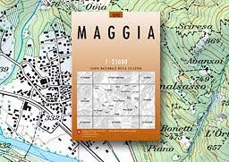
Among mapheads--more appropriately known as cartophiles--the maps produced by SwissTopo are widely regarded as the finest in the world. Each is a work of art with shading, coloring, and markings that effectively reveal the topography like no other maps you've ever seen. It's easy to look at a SwissTopo map and literally see the dimensions of a glacial bowl, the extent of marshland surrounding a lake, or the timberline with alpine pasture above.
SwissTopo maps are produced by the Federal Office of Topography, part of the Federal Department of Defense. Aside from their use in defense (they don't show landing strips and military installations) SwissTopo maps are loved by hikers because they include all marked trails, ski lifts, small hamlets, barns, and alpine cabins that often become waypoints for hikers in the Alps.
Alpenwild is the larges distributor of SwissTopo products and stocks an inventory of maps for the most popular hiking regions. The most popular and widely used maps by hikers are the detailed 1:25000 series--very comparable in size and scale to USGS quads. The 1:50000 series, with hiking routes printed in red, are also popular with alpine hikers. On long well-marked treks like the Haute Route the 1:50000 has the advantage of capturing the entire route on about 5 maps, whereas using the more detailed 1:25000 series would require 10 maps or more, depending on the precise routing.
SwissTopo also offers Swiss Map Online. This gives you access to all map scales and high resolution aerial photographs of the whole of Switzerland. Now hikers and other end user have access to the latest data and revisions.
For those who spend several weeks or months every year hiking in the Swiss Alps--especially those involved in trip planning--this is a great deal. But if you're the occasional alpine hiker or someone just spending a couple weeks in the summer, you'll probably want to just stick with the printed maps. That's what I do--I'm a 1:25000 guy. Old school, and loving it.